
Precision Agriculture: UAV, Satellite, Ground Sensor Fusion
Learn how to architect IoT sensor fusion across satellite, UAV, and ground sensors in precision agriculture, handling latency, bandwidth, and power limits.
Contents & prerequisites
Why Multi-Source Sensor Fusion Matters in Precision Agriculture
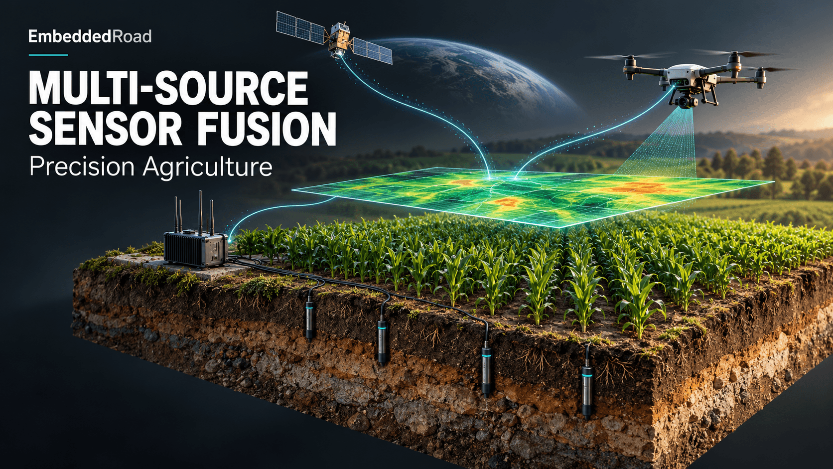
A single 2,000-acre corn operation generates three fundamentally incompatible views of the same field: a satellite pass every 5–16 days at 10 m/pixel, a UAV flight every 1–2 weeks at 2–5 cm/pixel, and a ground network reporting soil moisture every 15 minutes at a handful of fixed points. None of these alone is sufficient to drive an irrigation or spraying decision. The engineering problem isn't acquiring data — it's reconciling three streams with different spatial grids, different temporal cadences, and different failure modes into one coherent state estimate of the field.
Limitations of single-platform data
Satellite imagery is free or cheap and covers the whole farm, but it's blind under cloud cover and its revisit interval means a disease outbreak can run four to ten days before the next clean pass. UAV imagery resolves individual plant canopies but a single operator can only cover 50–200 acres per flight, and battery life caps flight time at 20–40 minutes per sortie. Ground sensors give continuous time series but at perhaps one node per 2–10 acres — spatial extrapolation from a soil moisture probe at 2 m depth to a point 200 m away is often wrong by a margin that matters for irrigation scheduling.
Yield prediction, irrigation optimization, and pest detection use cases
Yield prediction models want long, consistent time series — satellite NDVI trends over a season — cross-checked against ground truth from UAV multispectral passes at key phenological stages. Irrigation optimization needs near-real-time soil moisture (ground sensors) combined with canopy stress indicators (UAV thermal) to decide which zones to water today. Pest and disease detection is the hardest case: it needs the spatial resolution of UAV or ground imaging to catch an early-stage outbreak, but the trigger to fly often comes from an anomaly in satellite or ground data that says "look here."
Real-time vs. historical data trade-offs across platforms
The fusion architecture has to carry two time horizons simultaneously: a slow-moving historical baseline (satellite time series, soil EC maps) used for trend detection and model training, and a fast-moving operational layer (ground sensor telemetry, triggered UAV flights) used for same-day decisions. Conflating these — e.g., treating a 10-day-old satellite NDVI value as "current" canopy status — is a common design mistake that produces confidently wrong irrigation recommendations.
Data Sources: Characteristics and Native Resolution
Satellite imagery
Public constellations (Sentinel-2, Landsat) deliver 10–30 m multispectral bands on a 5–16 day revisit; commercial providers (Planet, Maxar) offer sub-5 m imagery daily but at material per-km² cost. Cloud occlusion routinely removes 30–60% of passes in temperate growing seasons, which means the effective revisit interval is worse than the nominal one and must be modeled as a stochastic gap, not a fixed schedule.
UAV payloads
Multispectral payloads (4–10 bands, red-edge and NIR included) are standard for NDVI/NDRE; thermal payloads detect canopy temperature differentials from water stress before visible wilting; hyperspectral payloads (100+ narrow bands) are used for research-grade disease signatures but produce 10–50x the data volume and require onboard or near-field compute to avoid saturating backhaul links. Raw hyperspectral cubes from a single flight can run into tens of gigabytes, making real-time uplink from the field impractical without pre-processing.
Ground sensor networks
Capacitive soil moisture probes, thermistors, and EC probes are typically battery-powered, reporting every 5–30 minutes, with node spacing driven by soil variability — 1 node per 2–4 acres for high-value irrigated row crops, sparser for dryland. These are archetypal constrained devices in the sense described in IoT Device Classification: Constrained, Gateway, Cloud — kilobytes of RAM, duty-cycled radios, multi-year battery targets.
Data rate and latency profiles per platform
| Platform | Native resolution | Update cadence | Typical payload per cycle | End-to-end latency |
|---|---|---|---|---|
| Satellite (Sentinel-2 class) | 10 m | 5 days (nominal) | tens of MB/scene | hours to days (provider processing + cloud gaps) |
| UAV multispectral | 2–5 cm | on-demand, weekly | 1–10 GB/flight raw | hours (flight + stitching) |
| Ground probe | point | 5–30 min | <1 KB/reading | seconds to minutes |
IoT Architecture for Multi-Sensor Ingestion and Edge Processing
Perception layer
Each platform speaks a different protocol natively: satellite providers expose REST/GeoTIFF APIs, UAV ground control software exports proprietary flight logs and imagery in vendor-specific containers, and ground sensors speak Modbus, LoRaWAN payloads, or vendor MQTT topics. This is precisely the fragmentation discussed in IoT Interoperability: Standards Gap and Fragmentation — there is no single perception-layer standard spanning satellite, aerial, and terrestrial agricultural sensing, so the integration burden falls on the gateway/edge tier, not the sensors themselves.
Network layer
Row-crop farms are frequently outside reliable LTE coverage. LoRaWAN is the default for ground sensor backhaul because of its multi-km range at sub-50 mW transmit power, but its ~50 kbps effective throughput rules out anything beyond telemetry scalars. UAV imagery needs local high-bandwidth transfer (Wi-Fi or wired docking at a field gateway) since cellular or LoRa uplink from a drone mid-flight is not viable for gigabyte payloads. Private 5G is increasingly deployed on larger operations specifically to support near-real-time UAV offload and multiple simultaneous gateways; the range/bandwidth/power trade-offs across these options are the same ones catalogued in IoT Connectivity Trade-Offs: Range, Bandwidth, Power, Cost.
Gateway and edge compute placement
A field-edge gateway (ruggedized, solar or mains powered) should do three things before anything leaves the farm: time-stamp and geotag every reading against a common clock, run first-pass filtering (dropping obviously faulty sensor readings — e.g., soil moisture >100% or EC negative), and perform UAV image stitching/orthomosaic generation locally rather than shipping raw frames to the cloud. This maps onto the perception/network/application split in IoT Architecture Layers: Perception, Network, Application, with the fusion logic itself living at the boundary between network and application layers.
Cloud ingestion and time-series alignment
Because satellite, UAV, and ground data arrive asynchronously, ingestion should write to a time-series store keyed by (field_zone_id, timestamp, source, variable) rather than forcing alignment at write time. Alignment — resampling ground time series to UAV flight timestamps, or reprojecting UAV orthomosaics onto the satellite pixel grid — happens at query/fusion time, not ingestion time, so that no platform's data is lost or distorted to fit another's schedule.
Fusion Algorithms: From Raw Data to Decision Support
Kalman filtering and particle filters for state estimation
Soil moisture state is a natural fit for a Kalman filter: ground probes give noisy direct measurements, a soil-water-balance model gives a predicted state (based on evapotranspiration and rainfall), and the filter reconciles the two, propagating state forward during the days between infrequent UAV/satellite updates. A simplified update step:
# z: ground sensor reading, R: measurement noise, Q: process noise
def kalman_update(x, P, z, R, Q):
    x_pred = x  # plus water-balance model term in practice
    P_pred = P + Q
    K = P_pred / (P_pred + R)          # Kalman gain
    x_new = x_pred + K * (z - x_pred)
    P_new = (1 - K) * P_pred
    return x_new, P_new
Particle filters are preferable when the state distribution is multimodal — e.g., pest spread, where the underlying process (wind-driven dispersal) doesn't fit a Gaussian assumption.
NDVI and spectral index computation from multi-source bands
NDVI = (NIR − Red) / (NIR + Red) is computed independently per platform, but band definitions differ: a UAV's NIR band center and a Sentinel-2 NIR band center are not identical, so raw NDVI values are not directly comparable across sources without a calibration/cross-walk step, typically a linear regression fit on overlapping acquisition dates.
Spatial interpolation between sparse ground sensors and dense satellite grids
Ordinary kriging is the standard method to interpolate ground point measurements across a field while using the satellite NDVI raster as a covariate (regression kriging), producing a moisture or stress map at satellite resolution that is locally corrected by ground truth rather than purely statistical interpolation.
Confidence scoring and anomaly detection across fused layers
Every fused pixel should carry a confidence score derived from recency (how old is the contributing satellite/UAV pass), source agreement (do UAV and satellite NDVI disagree beyond the calibration tolerance), and ground sensor health (battery voltage, last-seen timestamp). Anomaly detection — flagging a zone where ground EC spikes while satellite NDVI drops — should trigger a UAV re-fly rather than an automatic alert, since any single-source anomaly has a nontrivial false-positive rate.
Field Implementation: Deployment Patterns and Constraints
Power budgeting for ground nodes
A LoRaWAN soil probe transmitting a 20-byte payload every 15 minutes typically needs to budget for a multi-year deployment on a single battery pack or small solar panel; duty-cycling the radio and using a low SF (spreading factor) where link budget allows are the primary levers. Oversizing transmit power or over-sampling well beyond the agronomic need (soil moisture doesn't change meaningfully minute-to-minute) is the most common cause of premature battery failure in these deployments.
Data volume reduction: streaming vs. buffered upload from UAVs
Streaming raw imagery off a UAV in flight is rarely feasible given bandwidth; the standard pattern is buffered upload — the UAV records to onboard storage, lands, and docks at a field gateway for bulk transfer, with only lightweight telemetry (battery, GPS, flight status) streamed in real time over LTE or a proprietary radio link.
Latency requirements for actionable alerts
Irrigation scheduling tolerates latency on the order of hours — soil moisture state changes slowly. Spraying window decisions (weather + pest presence) tolerate tens of minutes at most, since the window itself may be short. Designing a single alerting pipeline with one latency target for all alert types either over-engineers the irrigation path or under-delivers on the spraying path; these should be separate pipelines with separate SLAs.
Interoperability challenges
Satellite providers each expose different REST schemas and authentication; UAV firmware exports proprietary log formats that change across vendor firmware versions; ground sensor vendors rarely agree on payload encoding even within LoRaWAN. Practically, this means the gateway/ingestion layer needs a per-source adapter, and any fusion engine should be built against a normalized internal schema rather than coupling directly to any vendor's native format.
End-to-End System Design: From Sensor to Agronomic Recommendation
Workflow orchestration
A workable pattern: satellite NDVI anomaly in a zone triggers a UAV flight request for that zone within 24–48 hours; the UAV flight's multispectral/thermal output is cross-validated against the ground sensors already present in that zone; only when UAV and ground data confirm the anomaly does the system raise a recommendation to the farm manager. This staged trigger chain avoids both satellite false positives (cloud shadow misread as stress) and unnecessary UAV flight costs.
Machine learning model retraining with multi-sensor ground truth
Yield and stress models should be retrained each season using UAV and ground data as labeled ground truth against satellite features, since satellite-only models drift as crop varieties, planting dates, and field boundaries change year to year.
User interface for farm managers
The interface needs three distinct views at minimum: a map view with confidence-shaded zones, a threshold-based alert feed, and a historical trend view per zone — farm managers generally trust a decision more when they can see the underlying time series, not just a binary alert.
Regulatory and data-ownership considerations
In multi-stakeholder deployments (farm owner, equipment vendor, agronomy consultant, satellite provider), contracts need to specify who owns the fused dataset versus the raw per-source feeds, since fused outputs often have commercial value distinct from any single input stream.
Lessons and Common Pitfalls
Clock synchronization across platforms and data integrity checks
Ground sensor clocks drift; UAV onboard clocks may not sync to UTC correctly if GPS lock is lost before image capture; satellite timestamps are provider-side and authoritative. Every ingestion pipeline should validate incoming timestamps against a plausible range and flag large skews rather than silently accepting them — a drifted ground sensor clock can silently misalign weeks of fused data before anyone notices.
Handling sensor drift and calibration drift over growing seasons
Capacitive soil probes drift with changing soil salinity over a season; UAV camera sensors drift with temperature and age. Periodic recalibration against a known reference (a calibrated handheld probe, a reflectance panel for UAV imagery) should be scheduled, not reactive.
Cost vs. coverage trade-off
Satellite coverage is nearly free per acre but temporally coarse; UAV coverage is detailed but expensive per flight-hour; ground density is the most expensive per-acre option at scale. The right mix depends on crop value per acre — high-value specialty crops justify denser ground networks and more frequent UAV flights than commodity row crops.
Future-proofing: modularity for adding new sensor types
New sensor types (soil carbon probes, in-field weather stations, next-generation hyperspectral payloads) will keep appearing; the ingestion and fusion layers should be built around the normalized schema and adapter pattern from the start, so adding a source is a configuration change, not a rearchitecture.
Learning
Sign in to track your progress.
Evidence
Public projects engineers linked to Precision Agriculture: UAV, Satellite, Ground Sensor Fusion.
No engineer has linked a project to this topic yet. Built something that proves it? Add the project and tag it with iot-connectivity-precision-agriculture-uav-satellite-ground-sensor- — it then shows here and on your public profile.